Exploring History
This Interpretive Story Map has been prepared to satisfy one of the stipulations of the Memorandum of Understanding between Butler and 40th LLC (the developer) and the Pennsylvania Historical and Museum Commission (the history agency of the state). This stipulation partially addresses the effect of the Arsenal 201, a mixed-use residential and commercial development, on historic properties. The Interpretive Story Map is focused on the Allegheny Arsenal, the U.S. Bureau of Mines: Pittsburgh Mining Experiment Station, and the Indigenous use of the project area.
Barracks/Non-Commissioned Officers
Allegheny Arsenal
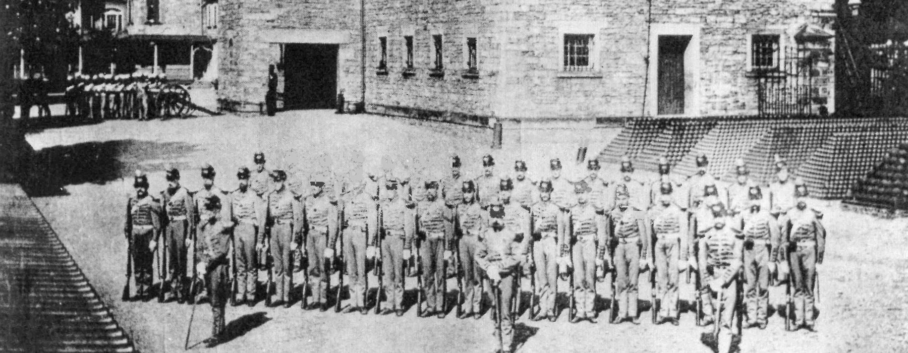
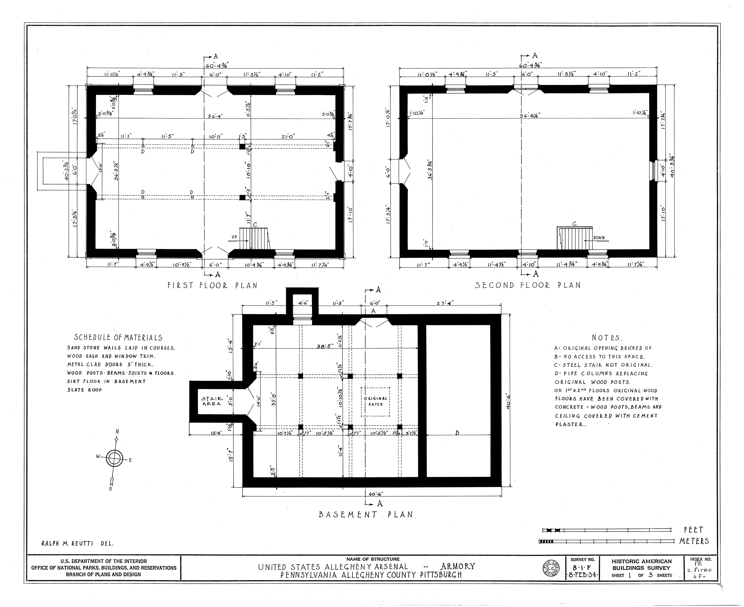
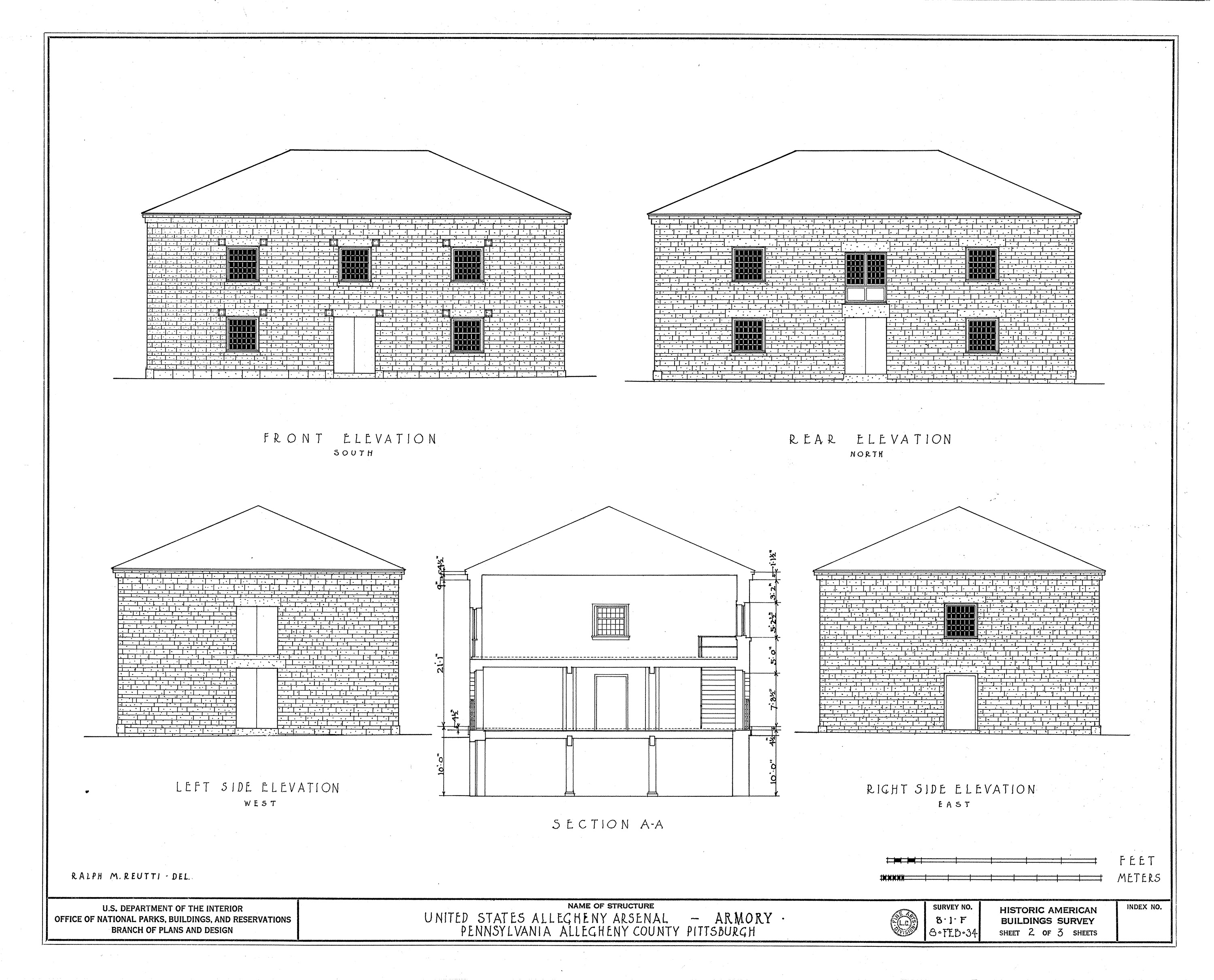
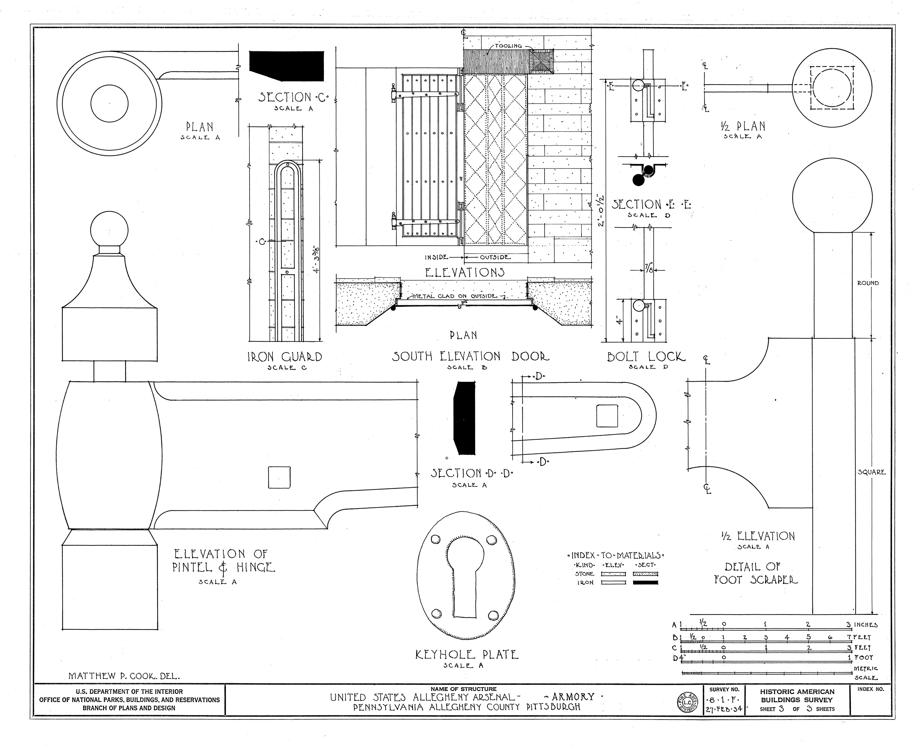
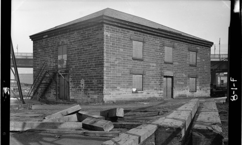
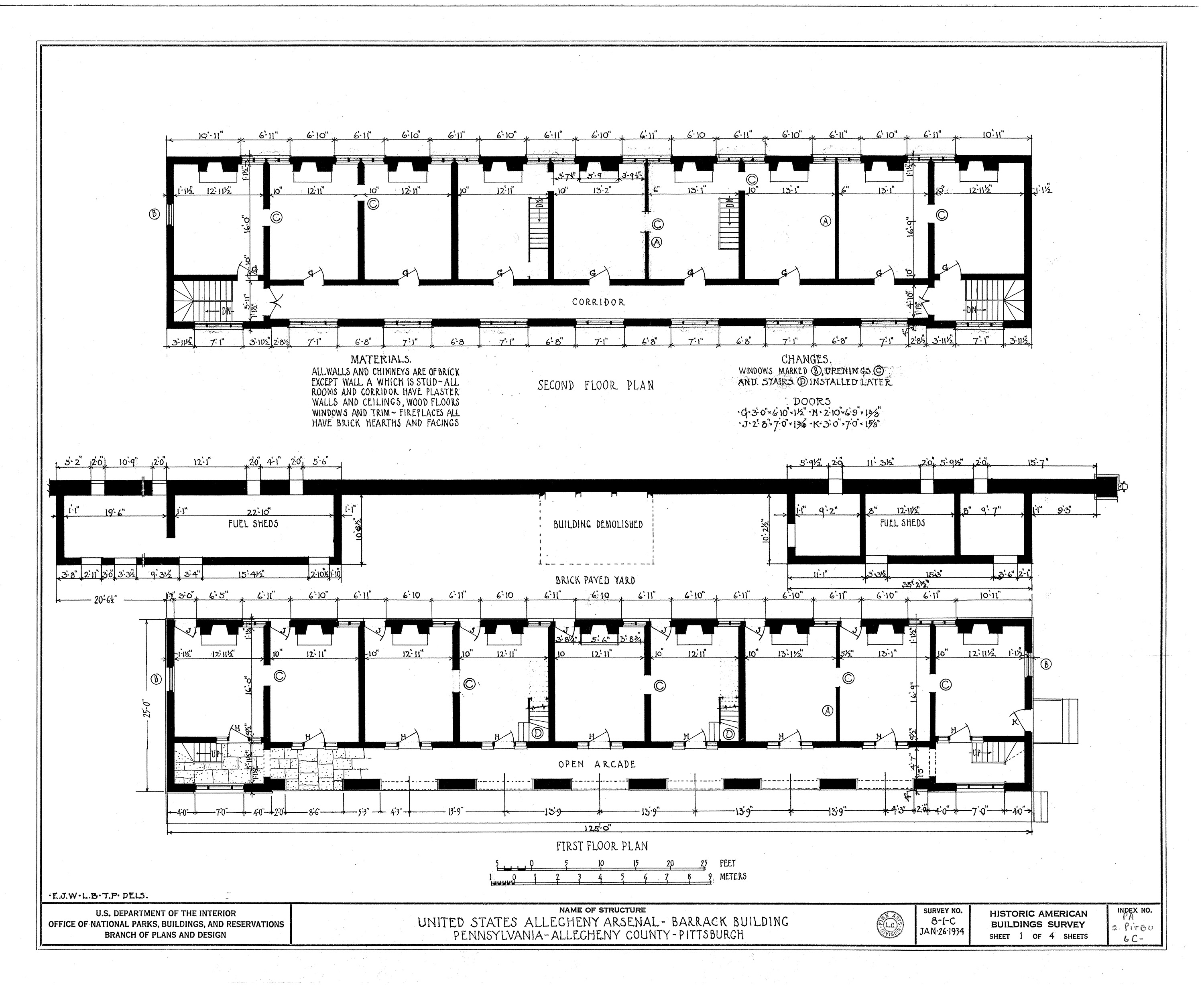
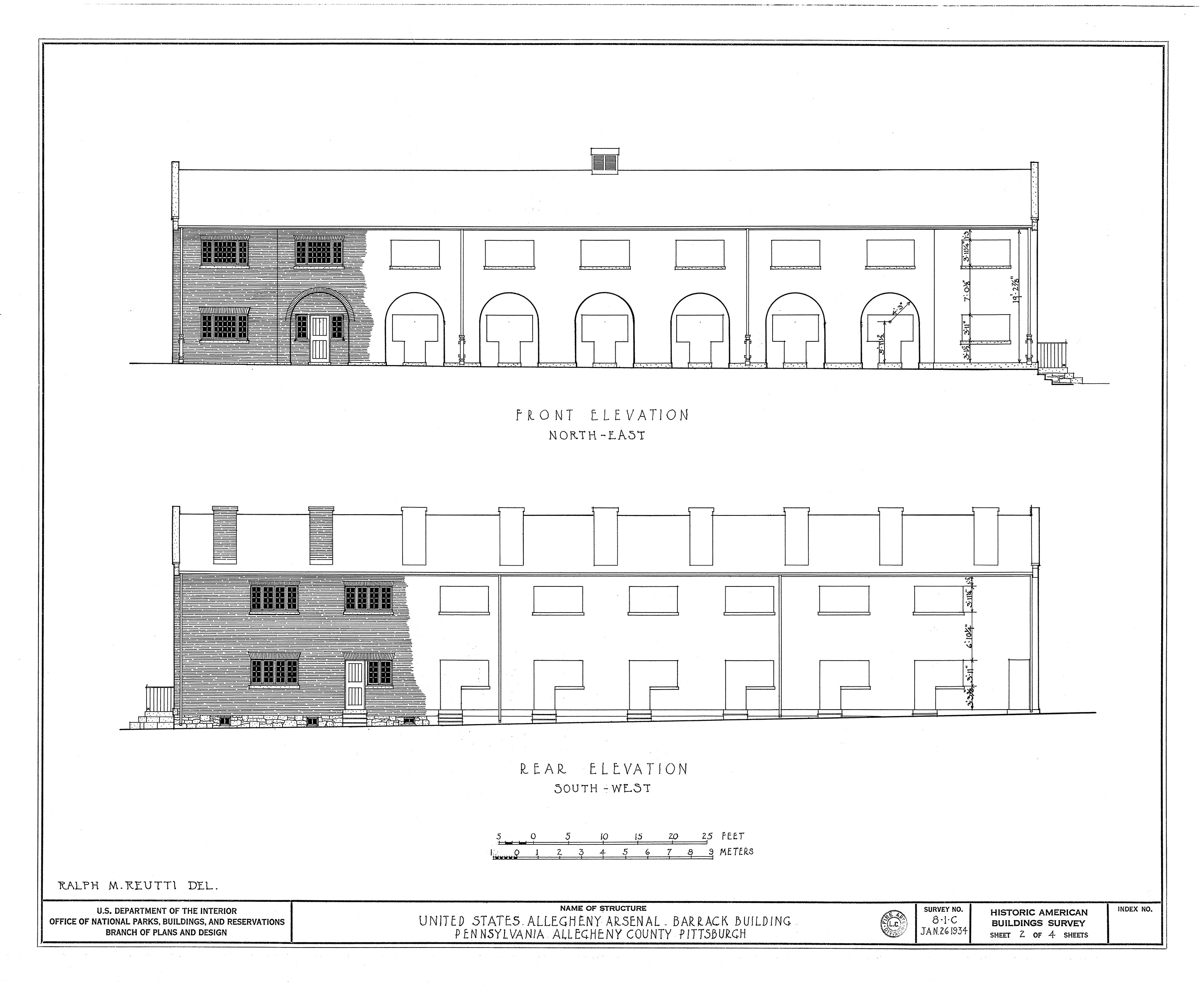
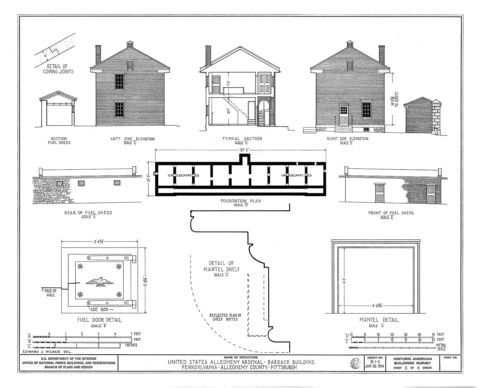
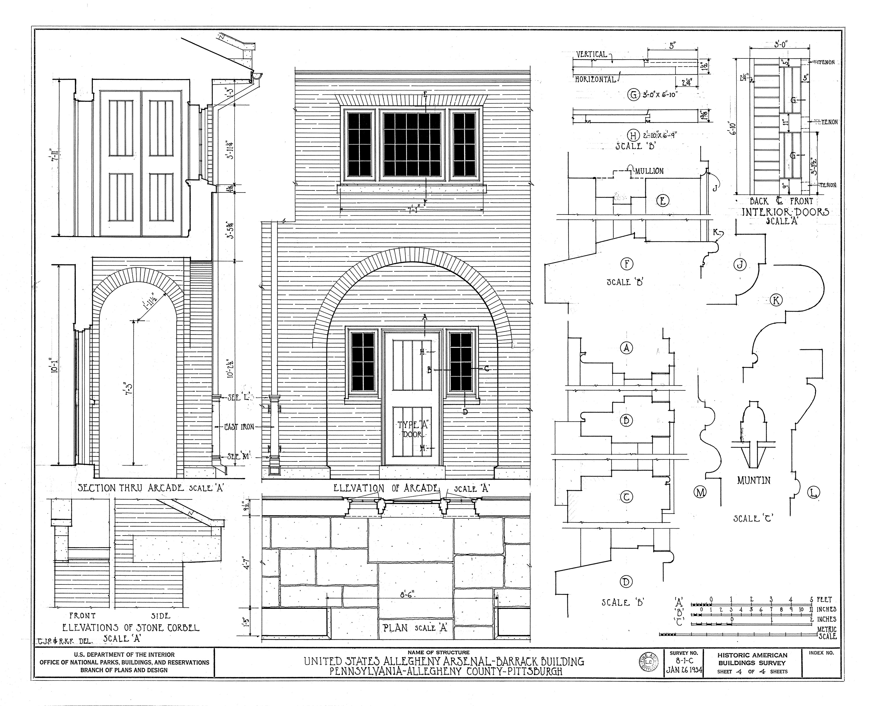
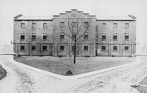
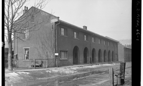
At least two Barracks and one Non-Commissioned Officers building were used to house some of the military personnel who worked at the Arsenal. The buildings appear to have been similar in style. Thousands of soldiers and hundreds of officers lived in the Arsenal at various times during the nearly 100 years the facility was garrisoned. This photo and detailed drawings show what the Barracks along 39th Street looked like in 1934. The Non-Commissioned Officers building can be seen in the background on the right side of the photograph.
Commandant's Quarters (1 of 2)
Alleghany Arsenal
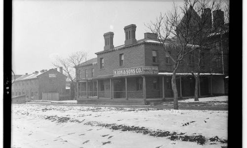
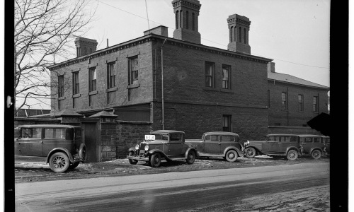
The Commandant of the Arsenal and his family were provided with their own separate house in the residential part of the facility. The term ‘Commandant’ is no longer used by the Army but was once the title given to the person in charge of a military installation. The Commandant did not necessarily need to hold a certain rank but was generally a Colonel or higher.
Commandant's Quarters (2 of 2)
Alleghany Arsenal
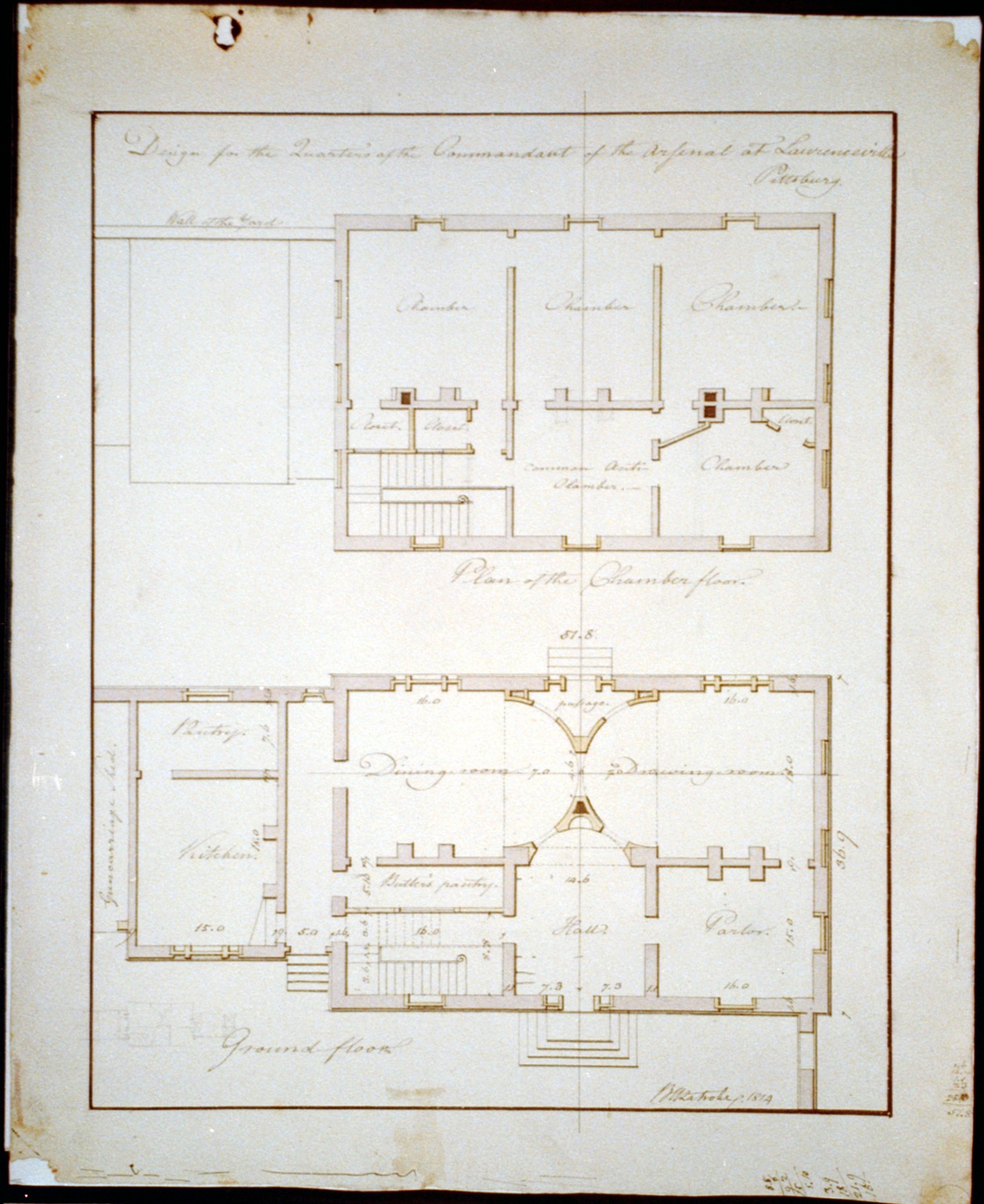
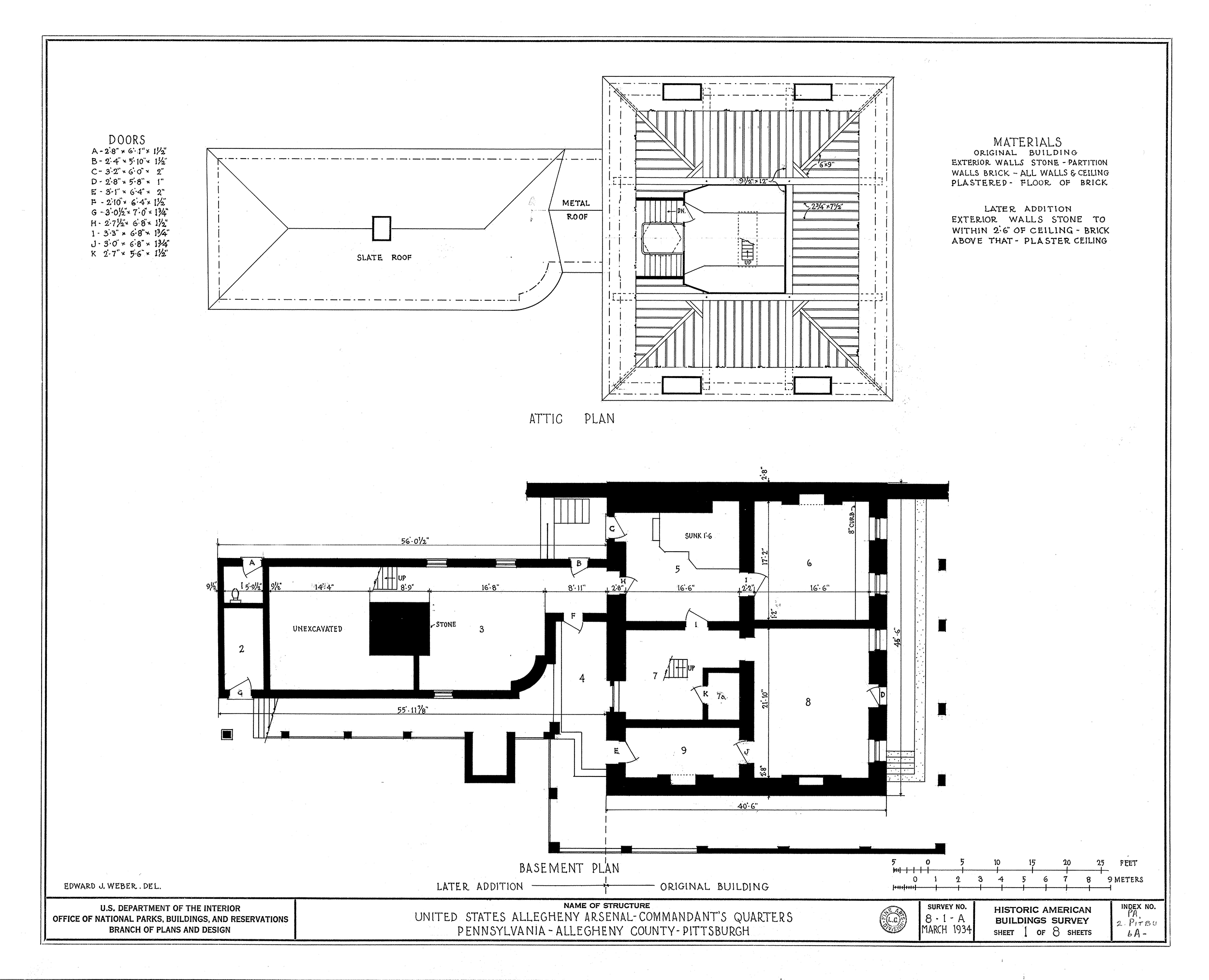
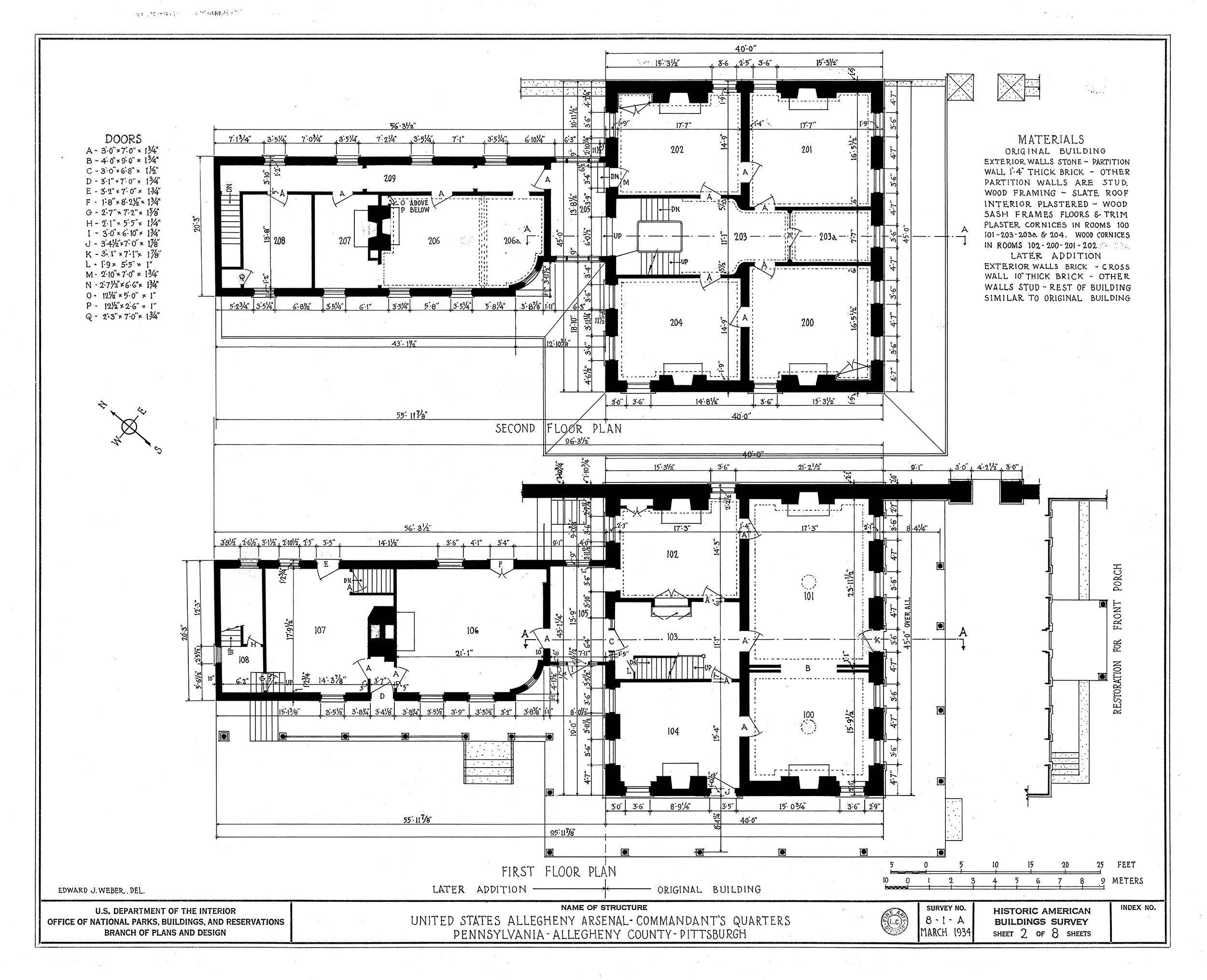
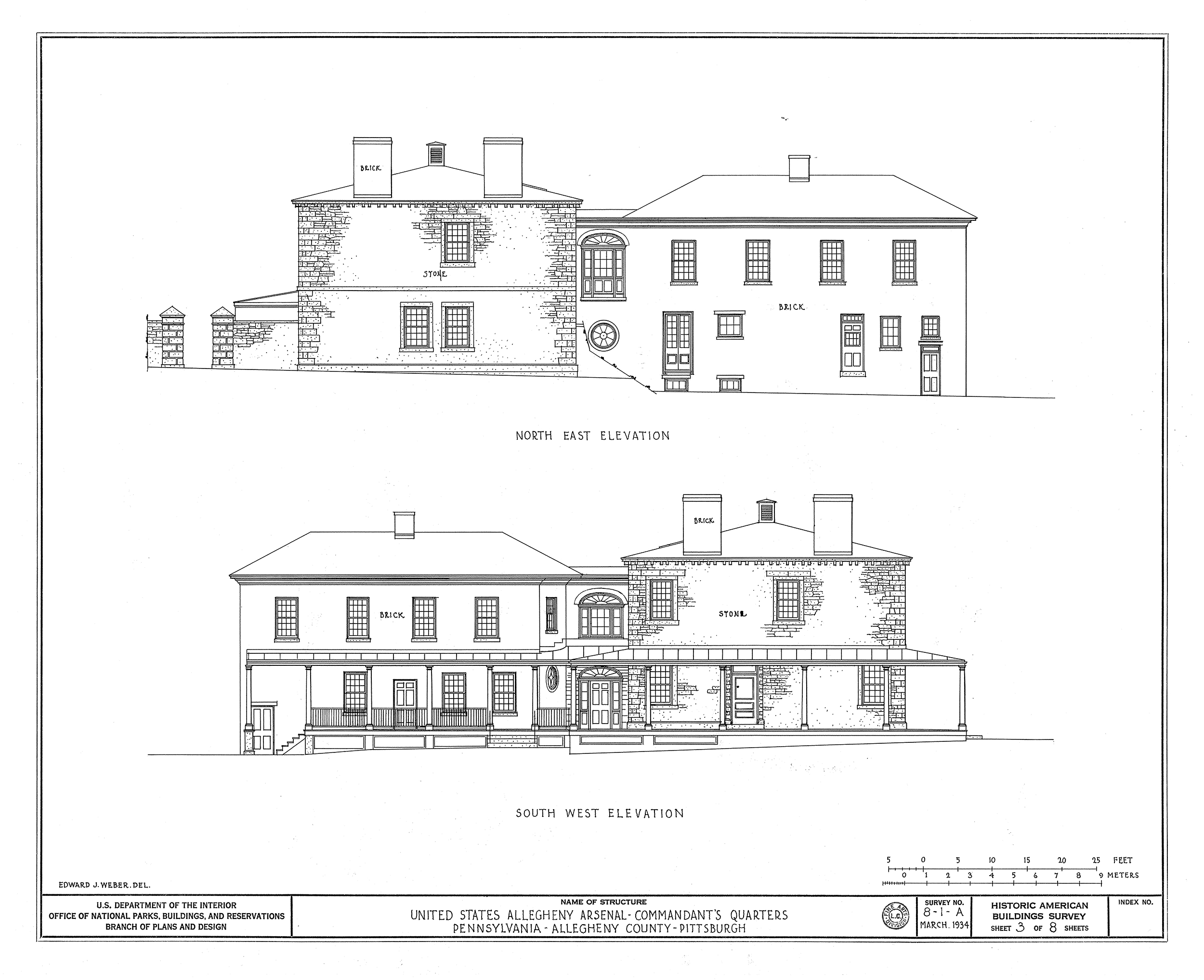
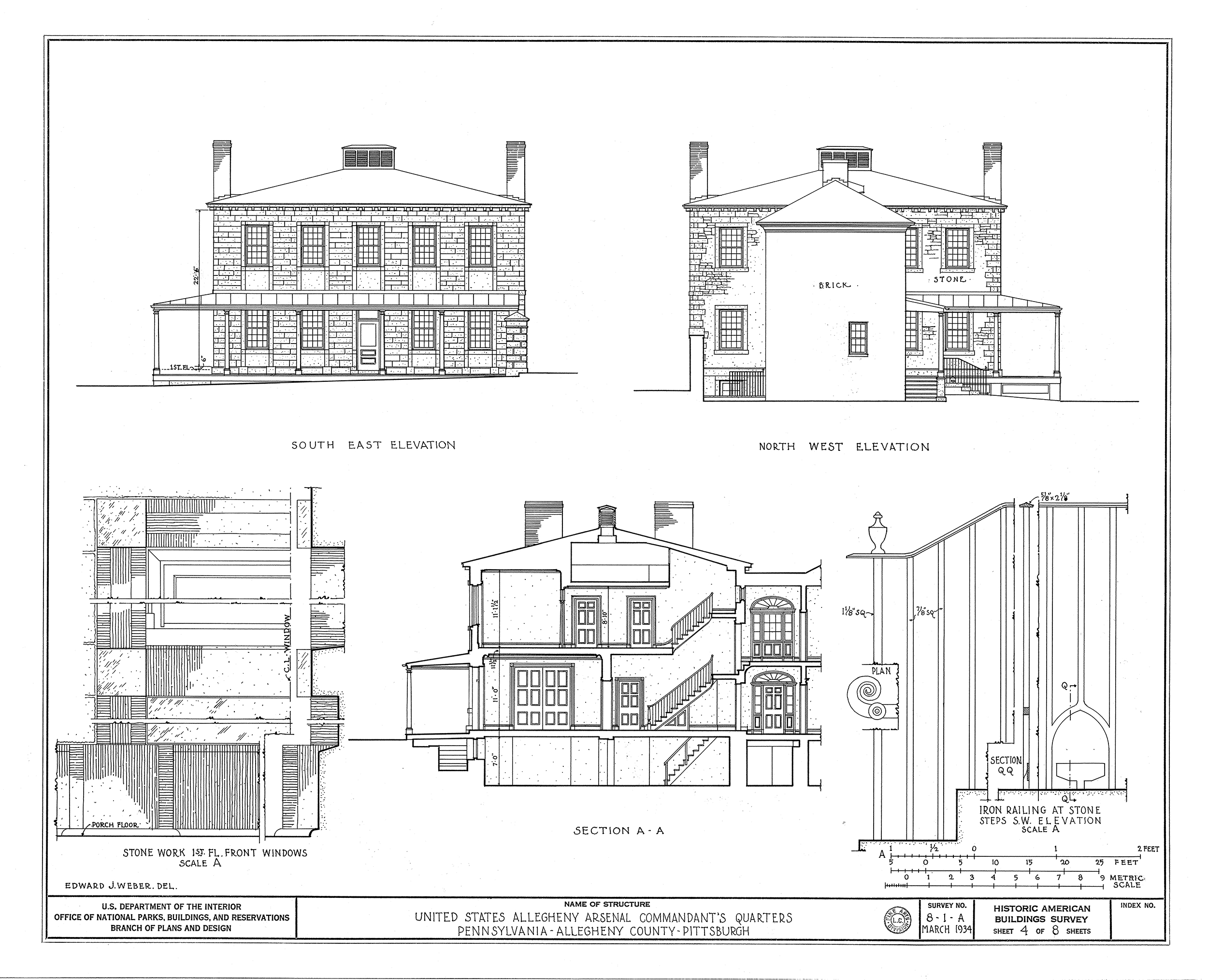
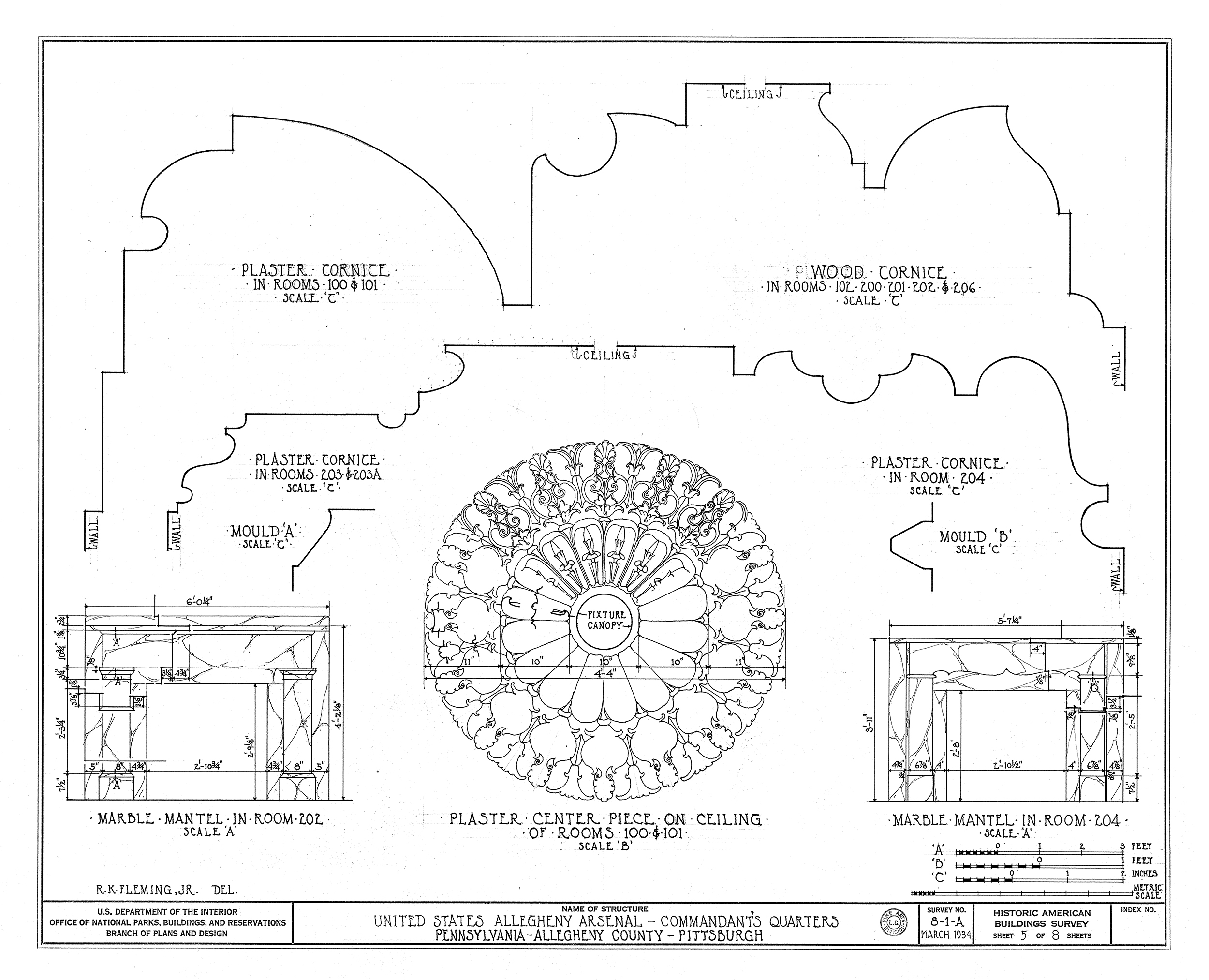
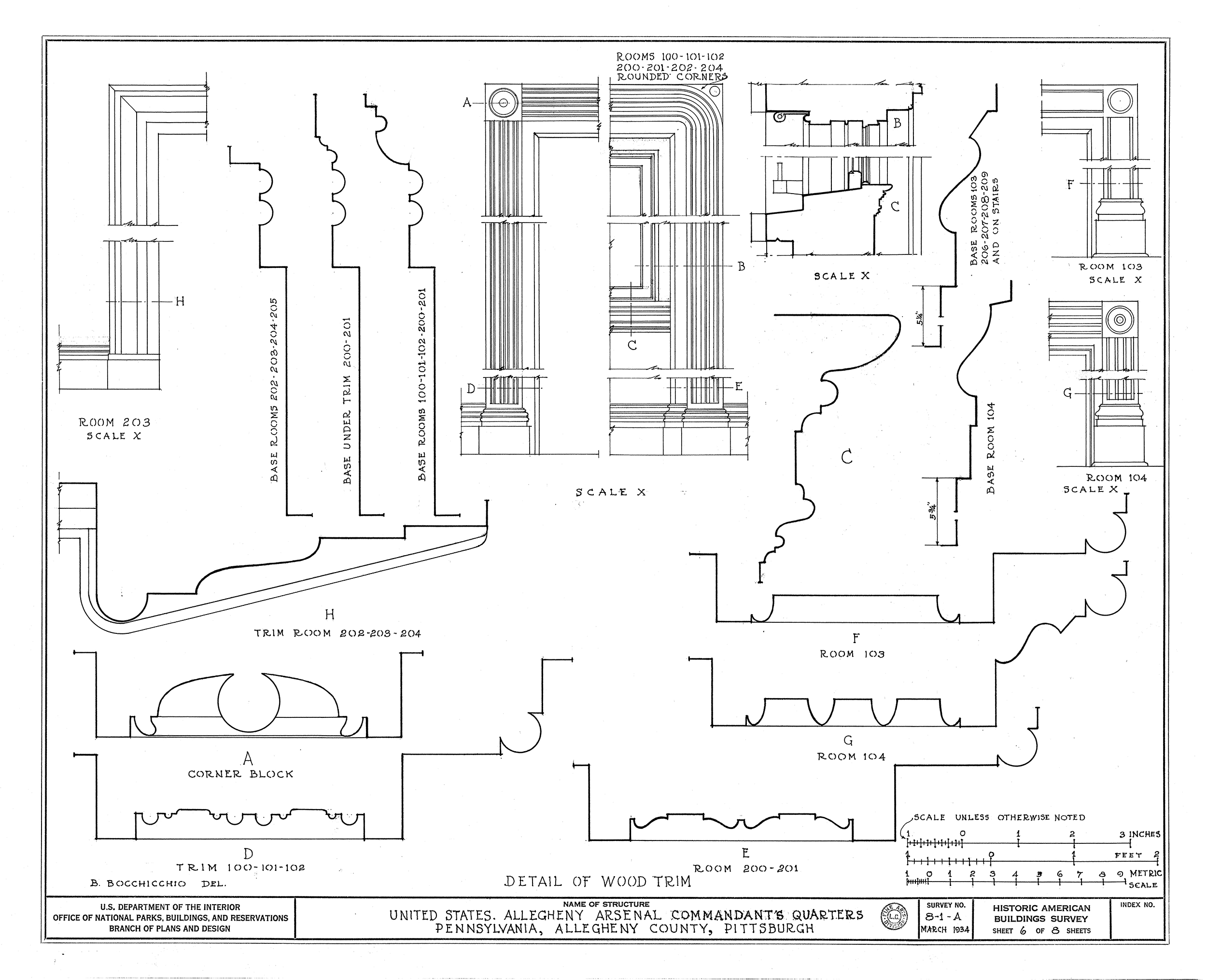
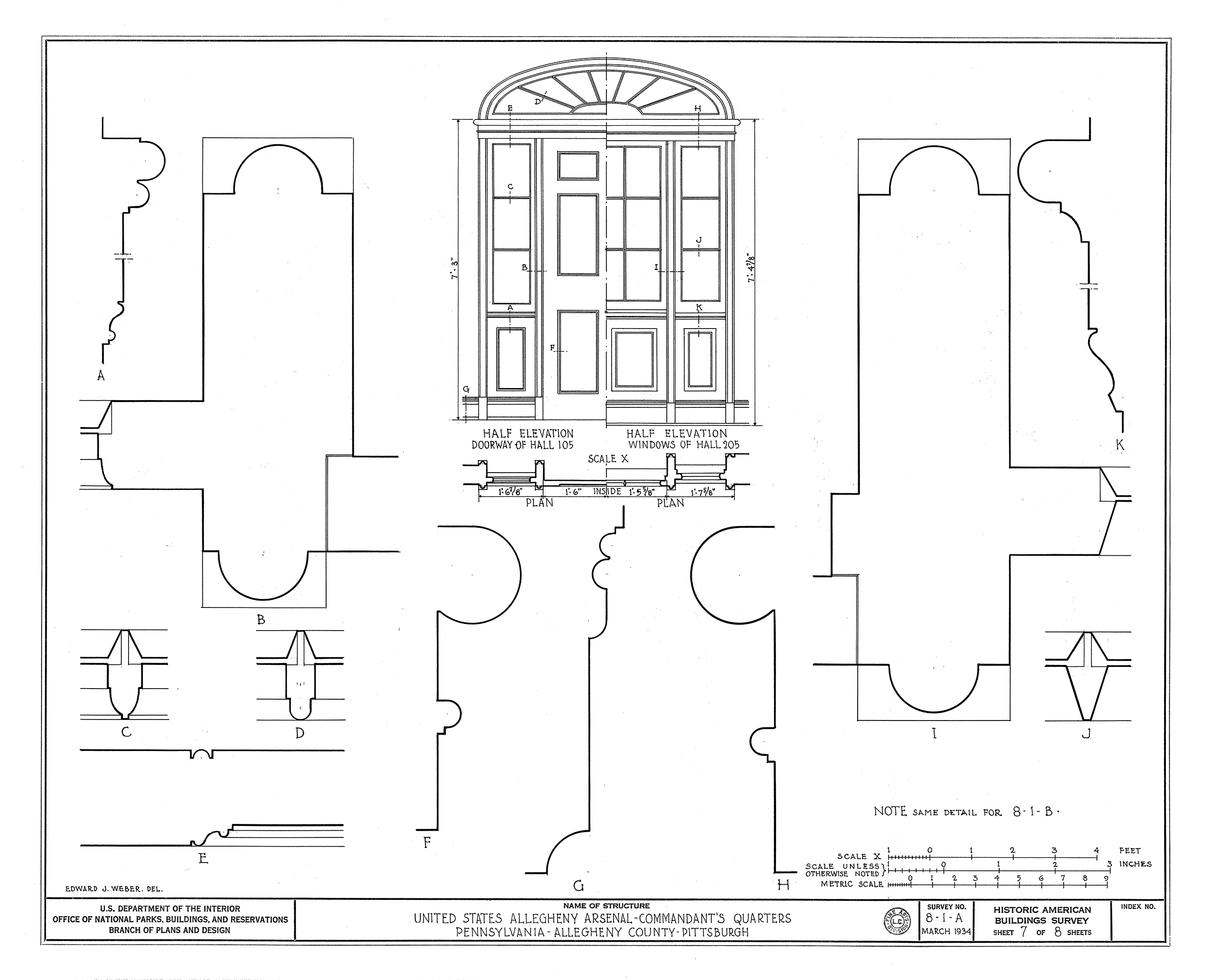
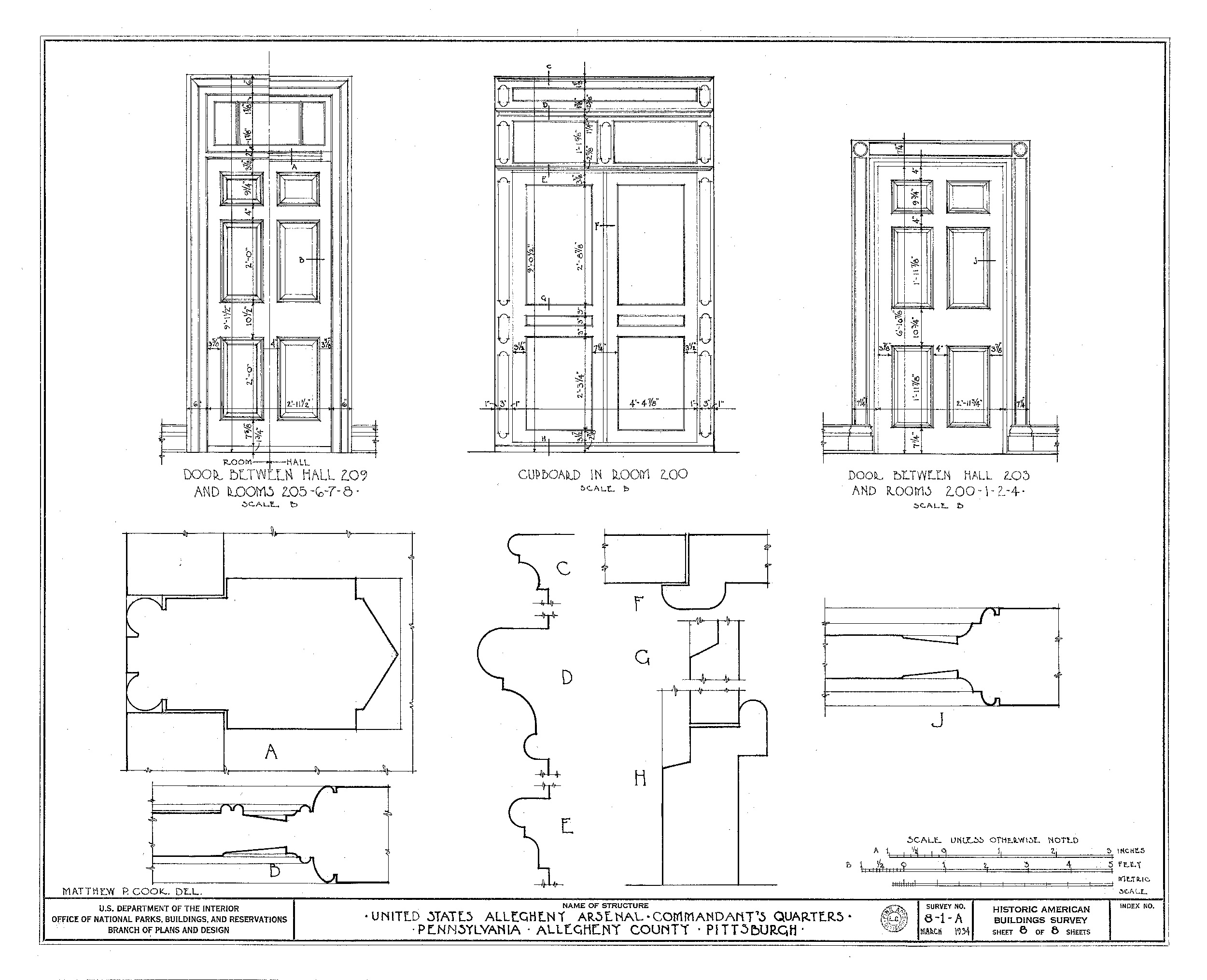
Colonel A. R. Wooly was the very first Commandant of the Arsenal and he oversaw the initial construction activities that begin in 1814. Captain Edward Harding was the Commandant of the Arsenal in 1850. Harding lived in the Commandant’s Quarters with his wife, Nancy, and their four children. The family had several live-in staff members, including two servants and a coachman. Harding passed away in 1855. More extensive research is needed to determine the names of other Commandant’s who were in charge of the Arsenal. These photos and drawings show what the Commandant’s Quarters looked like in 1934. There is also a drawing that shows the Commandant’s Quarters as originally planned in 1814 by the famous architect Benjamin Latrobe. As designed, the building had a grand entrance and a massive dining room with a vaulted ceiling. The kitchen and pantry area had its own entrance and was separated from the main house by a wide hallway. As built, the building was less grand but it did contain special design elements, such as decorative plaster cornices and center pieces on the ceilings.
Guard House
Allegheny Arsenal
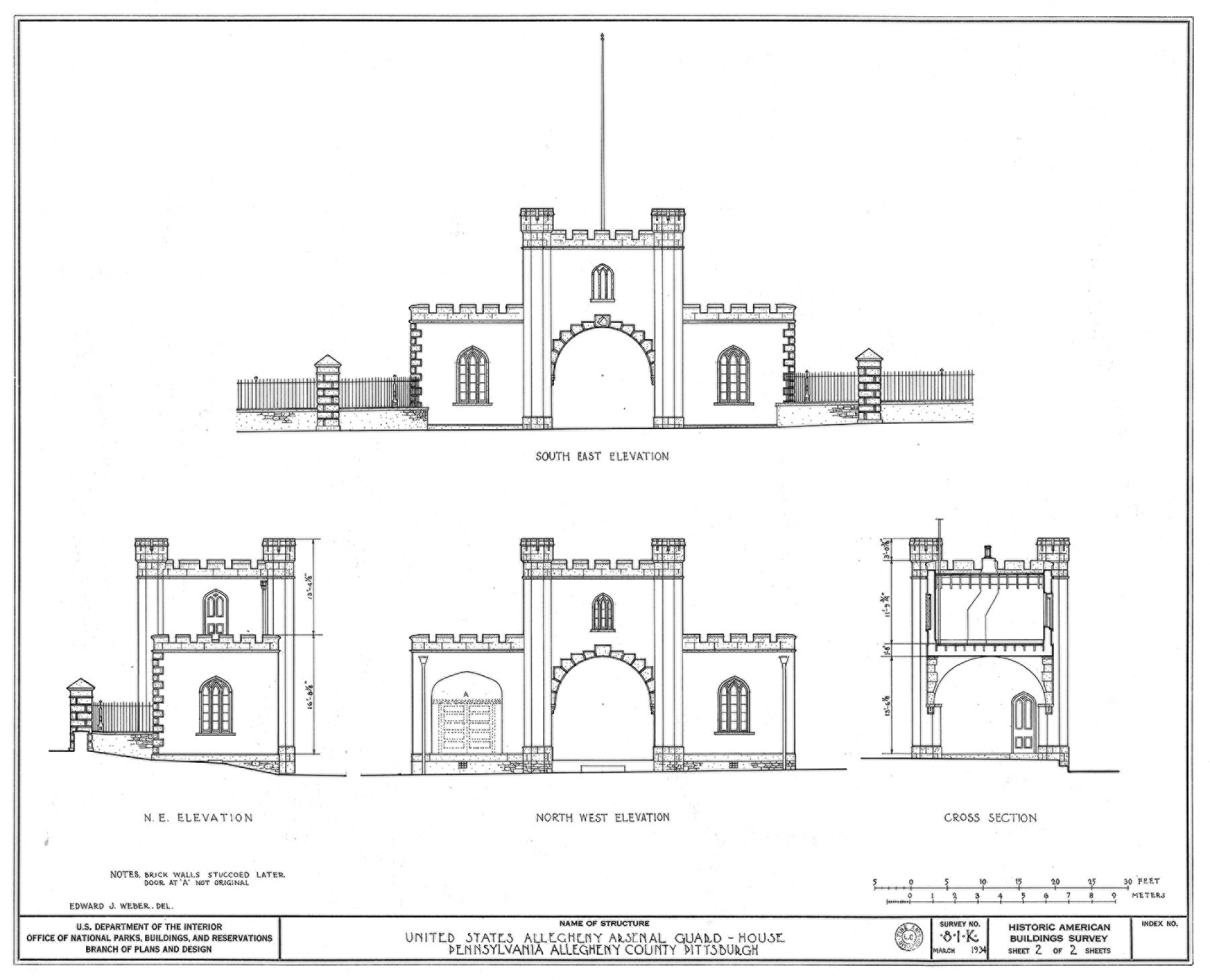
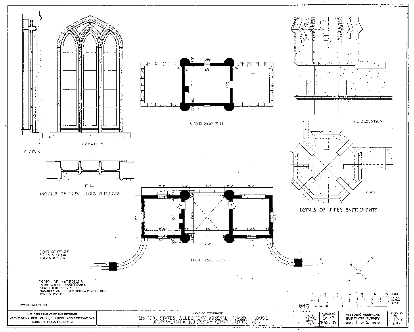
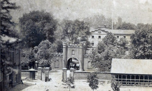
The Guard House was built in ca. 1857 to provide security for the military personnel who were stationed at the Arsenal. The building was located along Butler Street, which has always been a main thoroughfare through the area. The Guard House would have been a strong visual presence and reminder of the military-related purpose of the facility within this largely residential/commercial part of the Lawrenceville. The Guard House remained standing until 1947, long after the Allegheny Arsenal was decommissioned in 1906 and the property was no longer owned by the U.S. Army. This historic photograph shows what the Guard House looked like in 1868. The Arsenal Mess Hall can be seen in the background. Butler Street divides the two parts of the facility. These drawings show what the Guard House looked like in 1934.
Mess Hall
Allegheny Arsenal
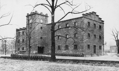
The Mess Hall was where the soldiers would eat their meals. Officers may have eaten in a separate area from the soldiers. The Mess Hall was three-stories tall and had a four-story clock tower centrally located on the side of the building that faced the Parade Ground. These photos show what the Mess Hall looked like in ca. 1900 to 1910.
Officers' Quarters
Allegheny Arsenal
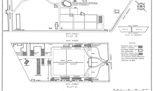
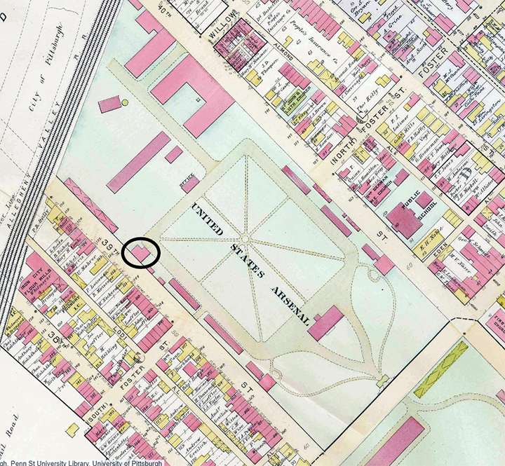
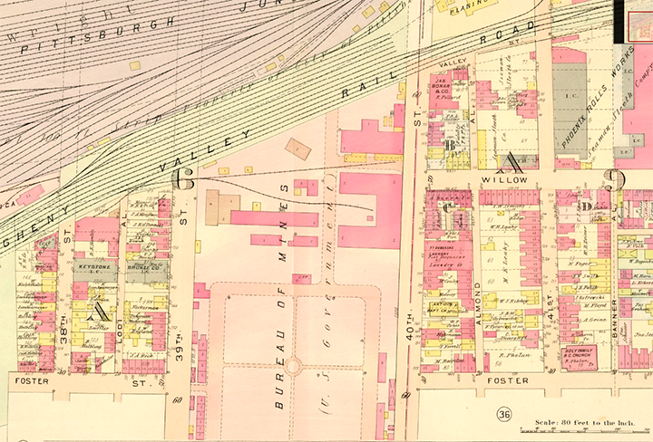
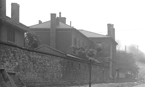
Commissioned Officers were housed separately from the enlisted men. Two Officers’ Quarters buildings were once located along 39th Street. The original one was built in 1814 and was located on the opposite side of the Parade Ground from the Commandant’s Quarters. These two buildings were very similar in style and design but the Commandant’s Quarters were for meant to house a single family while the Officers’ Quarters had separate spaces for single men and married men and their families. Neither of these buildings is still standing. The second Officers’ Quarters building was built in 1866, after the Civil War. This building is simpler in style and far less grand than the one built in 1814. The Officers’ Quarters built in 1866 is still standing. This historic map from 1890 shows the location of the Officers’ Quarters that was built in 1866. This historic photograph shows what the original Officers’ Quarters (built in 1814) looked like in ca. 1908.
Parade Ground
Alleghany Arsenal
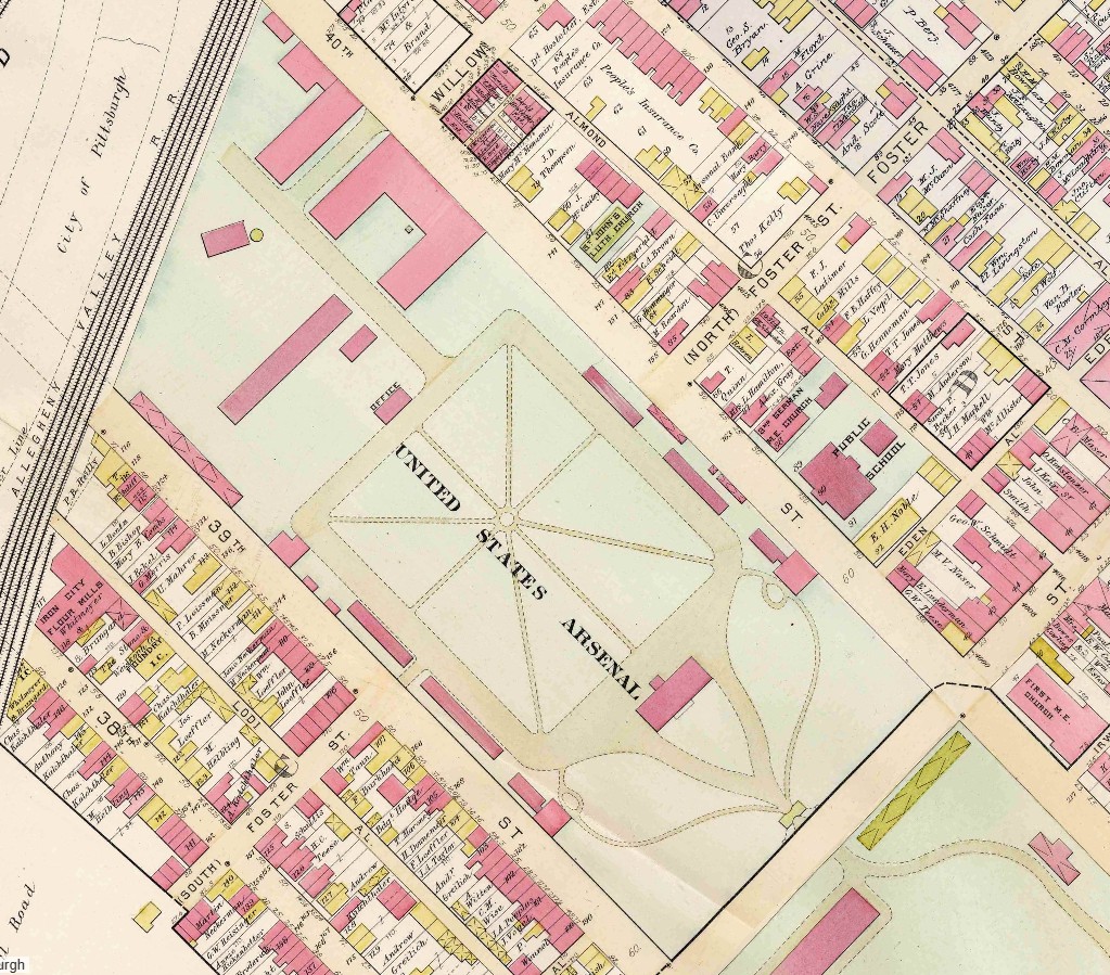
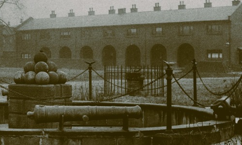
The Parade Ground was used for drills, training, ceremonies, and public events. The park-like setting with grassy areas surrounded by large shade trees and ornamental plantings was located in the residential part of the Arsenal. A wide pathway ran all the way around the perimeter of the Parade Ground. There was a circular fountain at the center and a flagpole near one end. This historic map shows what the Parade Ground looked like in 1890. This historic photograph shows what the circular fountain looked like in ca. 1905.
Workshops
Allegheny Arsenal
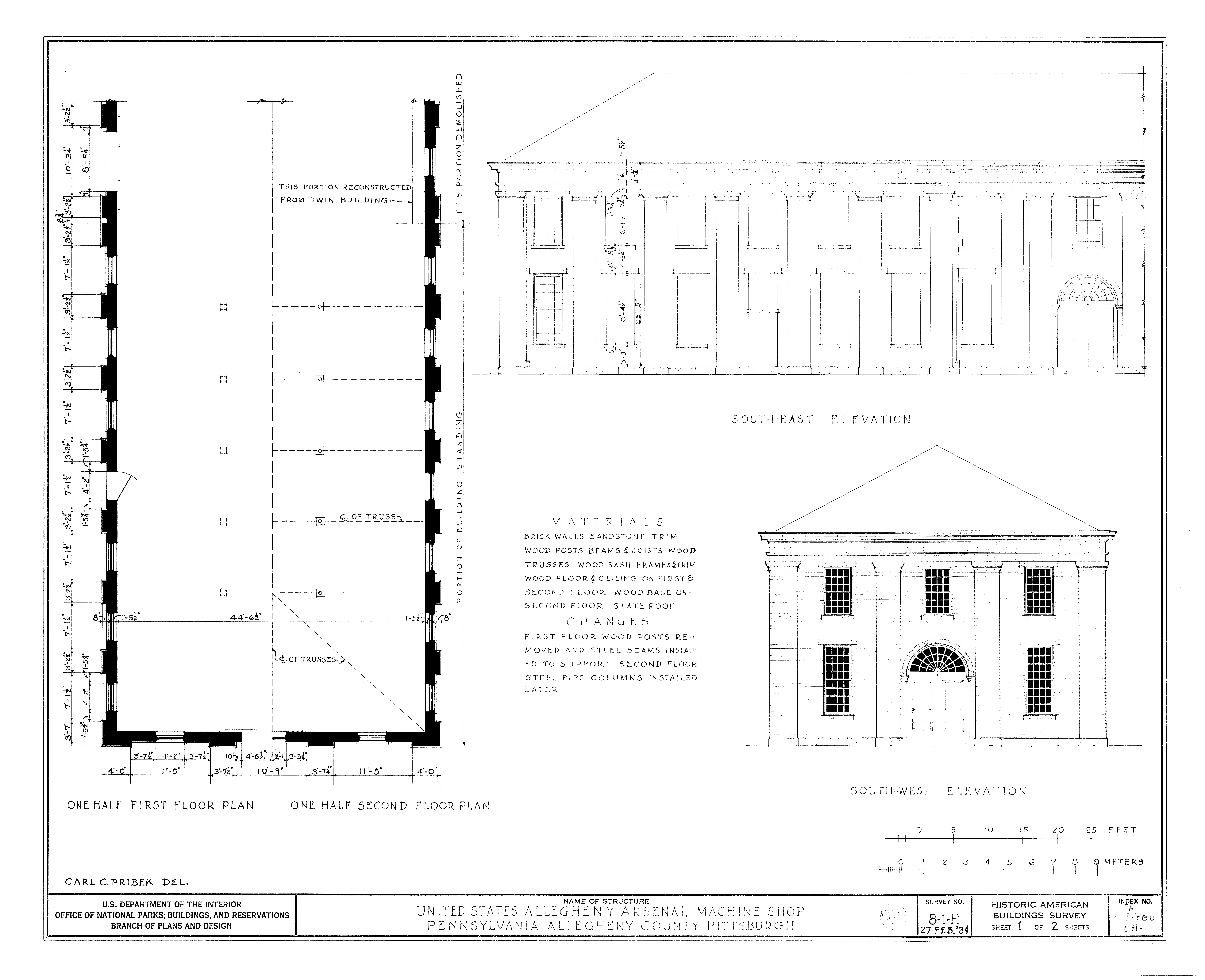
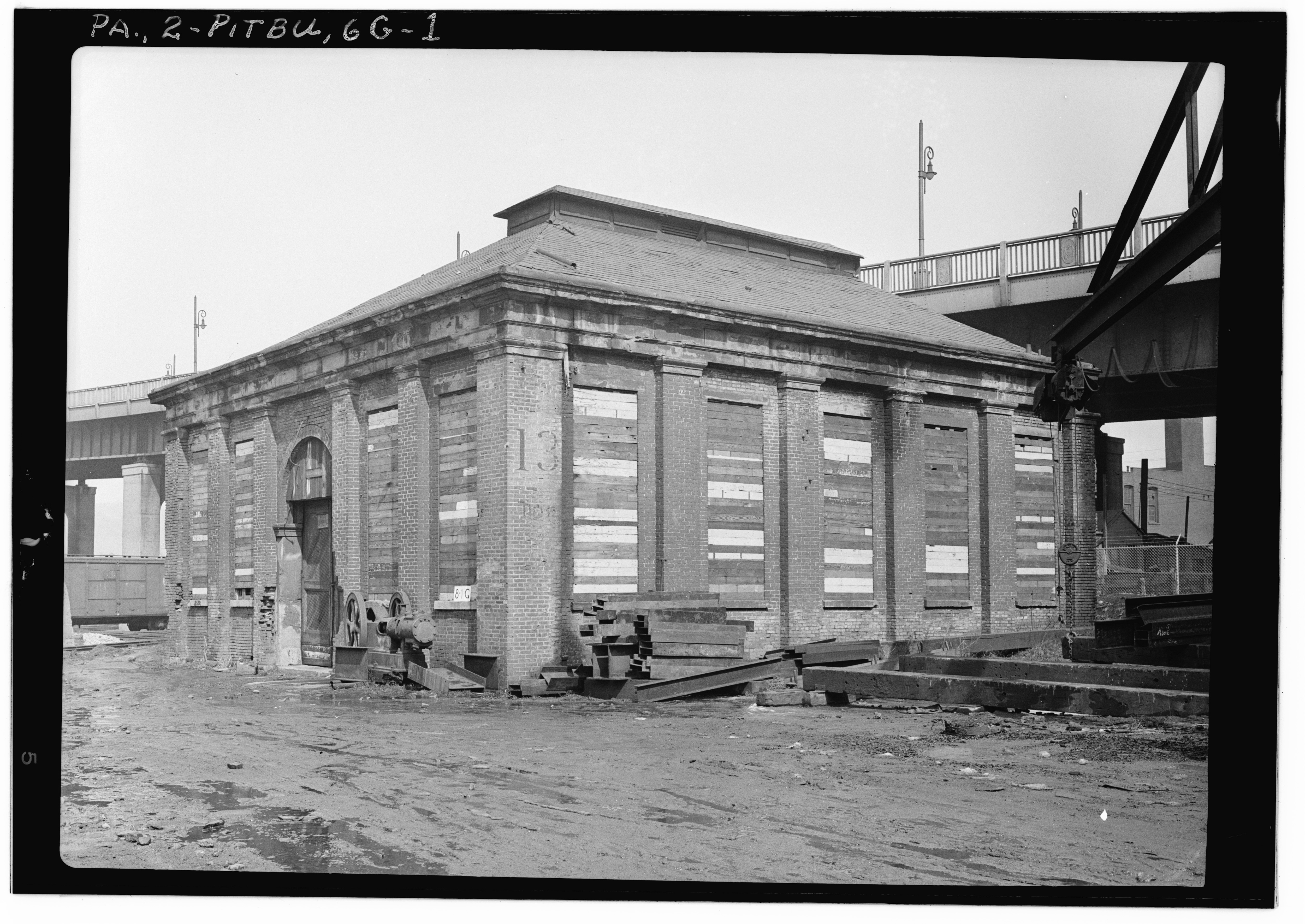
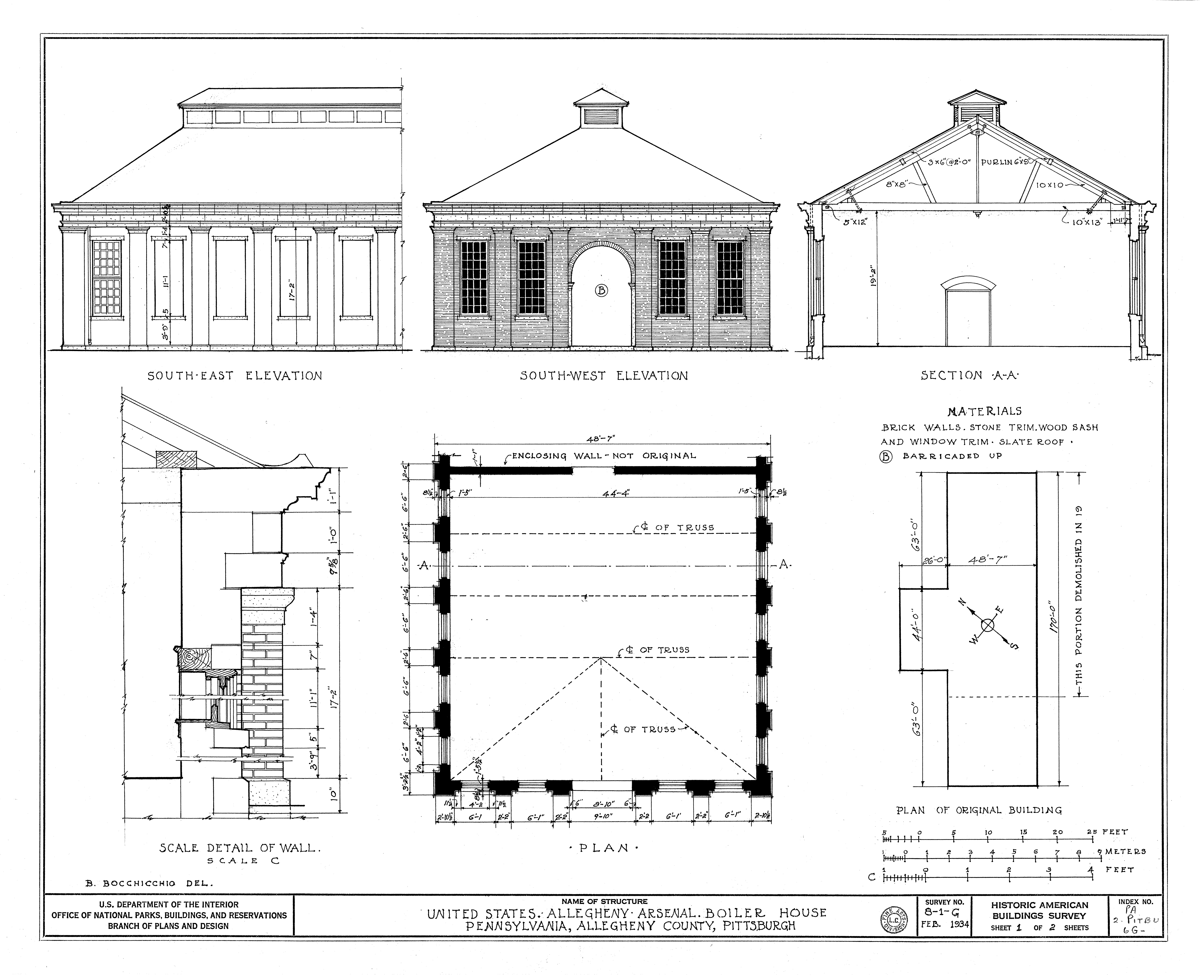
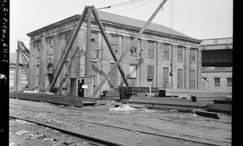
The U.S. Army used the Arsenal as a storage and manufacturing facility for gun carriages, horse and infantry equipment, and ammunition for almost 100 years. During that time, many changes occurred within the facility, often due to advancements in technology. New buildings were added and others were demolished. Buildings that were built for a specific purpose were remodeled for new uses. Even with all the changes, the manufacturing core of the Arsenal always remained located in the northwestern corner of the facility along 40th Street and the river. The manufacturing core was occupied by a cluster of one- and two-story brick Workshops and related buildings. At one time, these buildings included a Machine Shop, a Carriage Shop, a Boiler House, a Smith Shop, a Foundry, a Paint Shop, and a Storehouse. The Machine Shop was where they made or repaired various components of equipment and ammunition. The Carriage House was where they made gun carriages. Heavy artillery, like cannons, were mounted onto the carriages to make it easier to maneuver them around a battlefield. The Boiler House was in the same building as the Smith Shop and Foundry. The Boiler House provided the steam for various processes that were being done in the Smith Shop and Foundry. The Smith Shop was where they manufactured or repaired metal parts. The Foundry was where metal was melted into various shapes, like cannonballs. The Paint Shop was where they applied special protective coatings and finishes to the carriages and other equipment to increase their lifespan. The Storehouse was where they stored and distributed various nonfood-related supplies. Items like nails, paint, and tools needed for the construction and maintenance of the facility could have been stored in the Storehouse. These photos show what the Machine Shop, Carriage Shop, and Boiler House looked like in 1934. These detailed drawings show what the Machine Shop and Boiler House looked like in 1934.
Pittsburgh Storage & Supply Depot
1906-1908
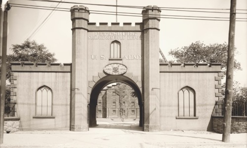
In 1906, the Army decided that the Arsenal was no longer needed for manufacturing and storage so it was briefly transformed into a supply depot under the Quartermaster’s Department. The Quartermaster was responsible for gathering and supplying any kind of metal or wood material that the Army needed. There were eight depots scattered across the United States that sent supplies to Army posts all over the world. Even though major upgrades were planned at this facility, hardly any were completed because the Depot only occupied the Arsenal for a few years. The Depot was led by Captain Frank A. Grant, who had served with the Utah Light Artillery in the Philippines during the Spanish-American War in 1898 and the Philippine Insurrection that followed in 1899. This undated historic photo shows new signage for the Depot painted onto the Guard House. (At that time, Pittsburgh was spelled without the letter ‘h’ on the end.)
World War I
1917-1918
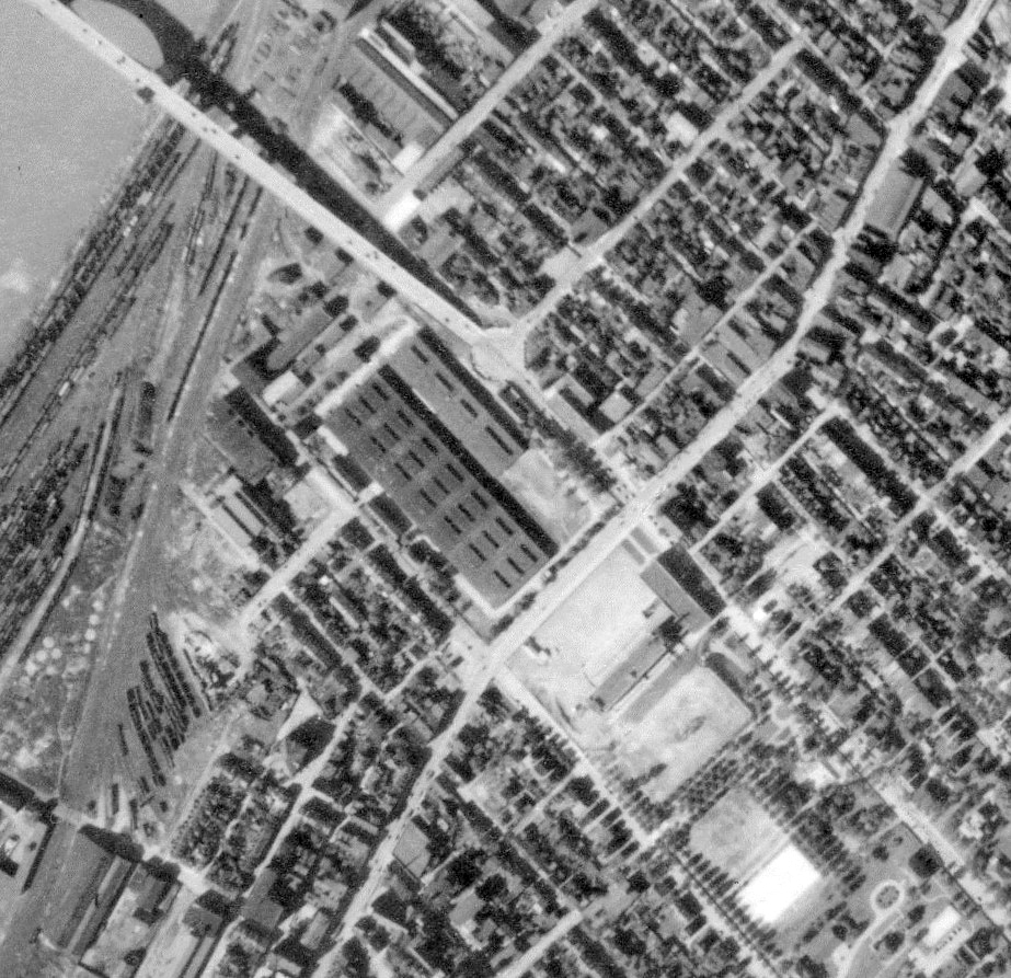
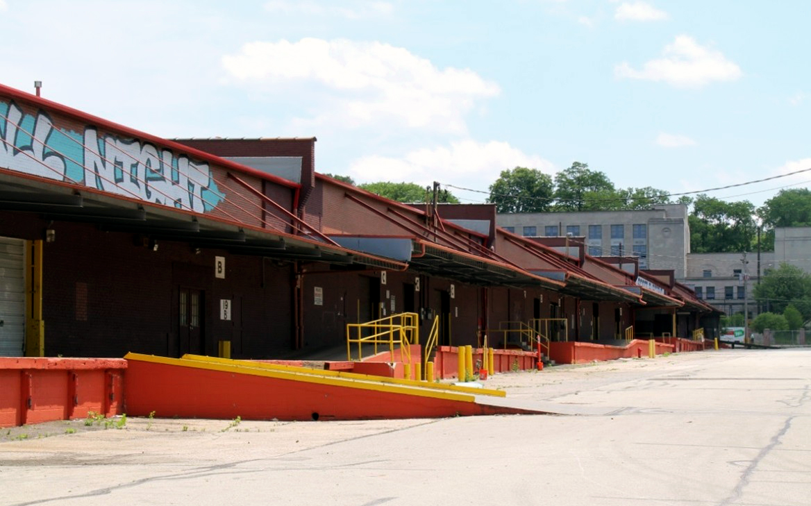
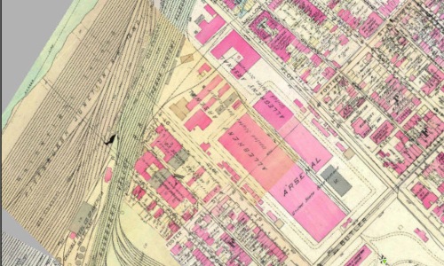
World War I (WWI) began in 1914 but the United States did not become directly involved until 1917. In that same year, plans were made for two one-story brick fireproof buildings to be constructed within the former Arsenal to be used as warehouse space for the U.S. Army. Captain John M. Taylor was in charge of the work and the construction contract was awarded to the Austin Company of Cleveland, Ohio. Work on the buildings began in December 1917 and was completed by July 1918. WWI ended four months later. The warehouses were placed within the former Parade Ground and required demolition of the Mess Hall. This significantly altered the cultural landscape of the facility. Local Pittsburgher’s sometimes associate these warehouses with the Arsenal. The buildings did occupy a large amount of space within the grounds but they never functioned as part of the Arsenal. This historic map from 1920 and this historic aerial photograph from 1939 show how large the buildings were compared to the rest of the facility. This recent photograph shows what the warehouses looked like in 2016 before most of them were demolished. As of 2025, one small segment of the warehouses remains along 40th Street.
Howard Heinz Warehouses
1926-1946
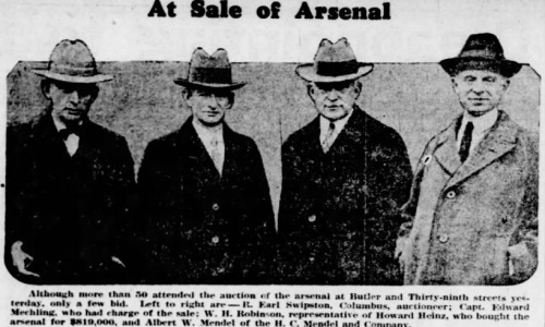
In 1926, the federal government sold the northern portion of the Arsenal property at auction, including 16 acres and 20 buildings, to Howard Heinz. Heinz was then President of the H. J. Heinz Company, a food processing company with world headquarters in Pittsburgh. Heinz used the two existing warehouses that were built during World War I for general storage and he leased the other buildings on the property for use as dwellings or shops. By 1946, the Heinz family had sold the property to the Arsenal Terminal Warehouse. This newspaper article from 1926 shows a picture of the men involved in the Heinz purchase of the Arsenal. The purchase price of $819,000 is roughly equivalent to $14,925,000 in 2025.
Butler Street
Lawrenceville Neighborhood
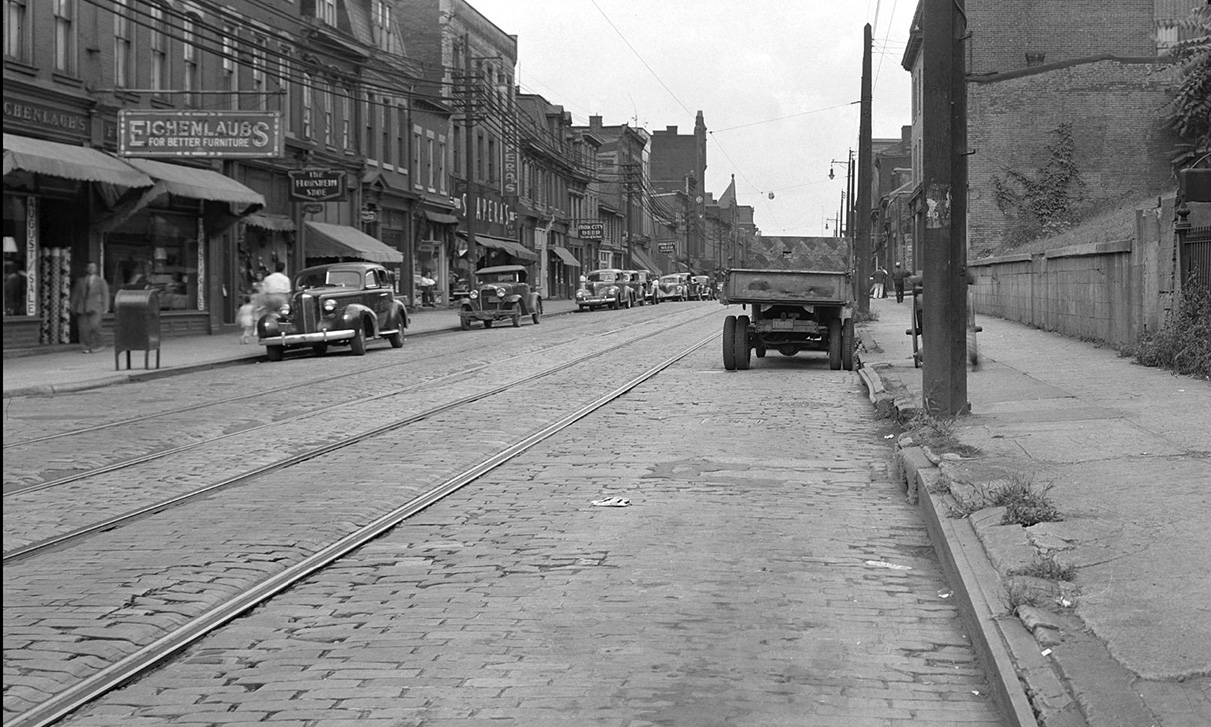
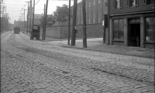
In 1814, when the federal government purchased this property for the purpose of building the Allegheny Arsenal, the location was in a sparsely populated area on the far outskirts of Pittsburgh. Over the next 50 years, the area around the Arsenal became a densely packed urban neighborhood. Butler Street, which divided the Arsenal and was a very early local road, became the primary commercial corridor in Lawrenceville. These historic photographs are of Butler Street. One photograph shows what Butler Street looked like in 1909. The Arsenal is visible in the background on the right side. The other photograph is what Butler Street looked like in 1939 and was taken about two blocks away from the Arsenal.
Stone Walls
Lawrenceville Neighborhood
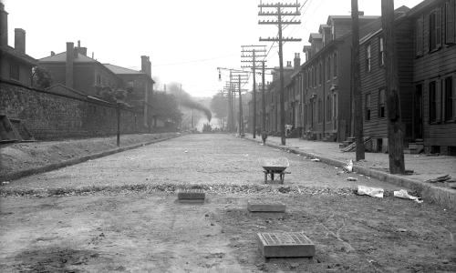
To the surrounding neighborhood, the most visible part of the Arsenal were the stone walls that once entirely enclosed the complex. The stone walls are believed to have been built in ca. 1814, around the same time construction began on the facility. The walls extended around the entire perimeter of the Arsenal along 39th and 40th Streets, Penn Avenue, Butler Street, and the Allegheny Valley Railroad. The walls were once 14 feet tall or higher in some places and, in other places, incorporated Arsenal-era buildings. Later, some of the walls were lowered and capped by iron fencing. Numerous openings were added and then infilled while other portions were subjected to maintenance and repair work that was not historically accurate. Today, there are 19 wall segments remaining of various lengths, heights, and states of integrity. Ten of the wall segments are located along 39th Street with one of these fragments used as the foundation wall for the Officers’ Quarters. Three fragments are located along Penn Avenue, with one of these segments rounding the corner of Penn Avenue and 40th Street. Five segments are located along 40th Street. The longest intact segment is the wharf wall along the Allegheny Valley Railroad. This historic photograph shows what a portion of the wall along 39th Street looked like in 1908 (after the Arsenal was decommissioned). It shows how Arsenal-era buildings were incorporated into the wall, as well as other types of openings, and some of the iron fencing. This photograph also shows neighborhood houses on the opposite side of the 39th Street.
40th Street Bridge (Washington Crossing Bridge 1924)
Lawrenceville Neighborhood
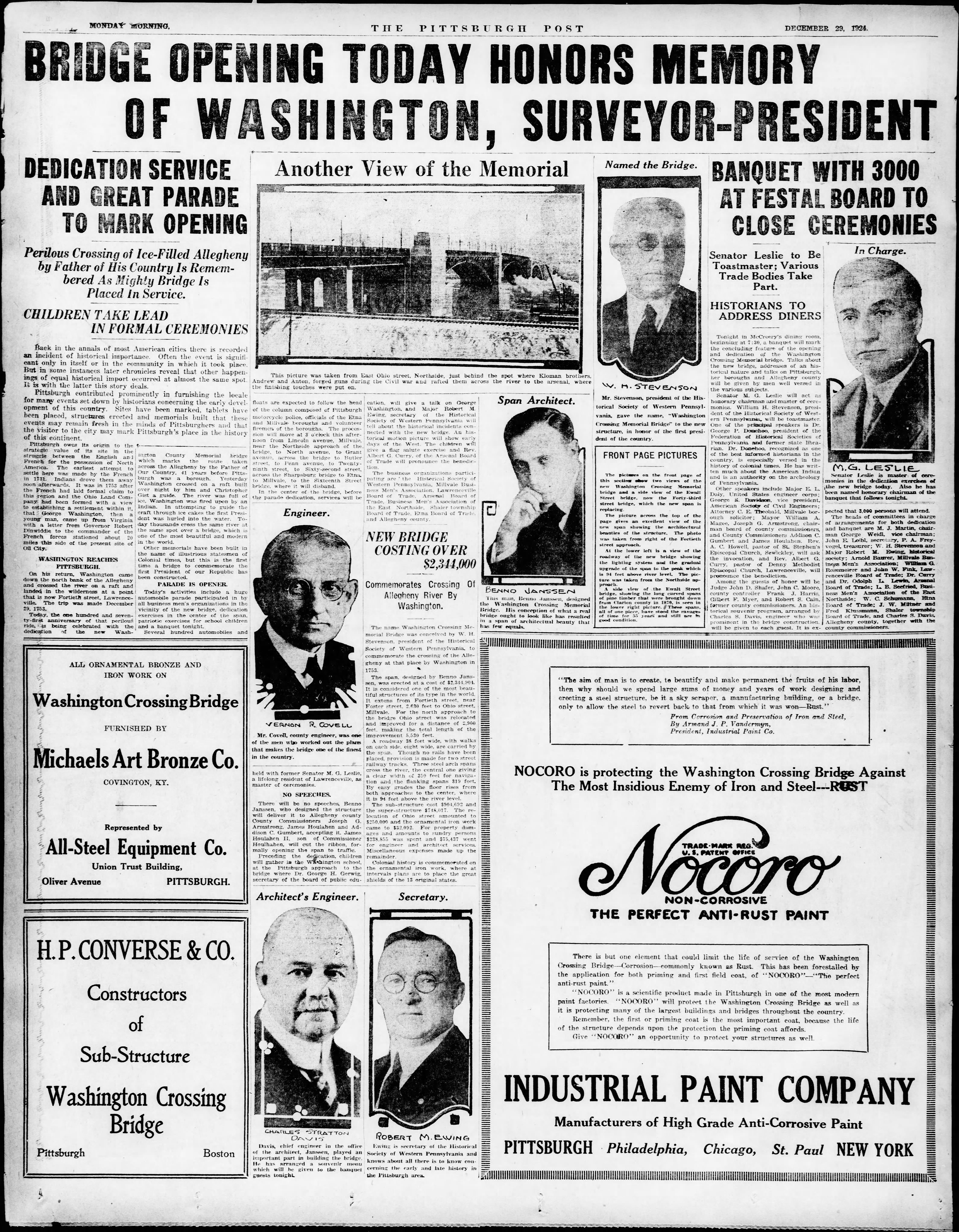
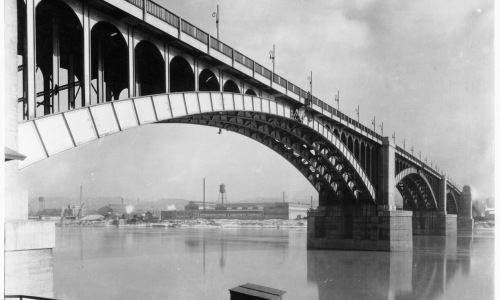
The 40th Street Bridge (Washington Crossing Bridge) was constructed in 1924 across the Allegheny River to provide a connection to Lawrenceville. A small part of the Arsenal was needed to make room for the approach spans and several of the old Arsenal buildings had to be demolished. The location of the bridge was selected to commemorate the place where Major George Washington and his guide, Christopher Gist, crossed the Allegheny River and nearly drowned in December of 1753. Washington had been dispatched to the area on a special mission to confer with the French. The 40th Street Bridge is listed on the National Register of Historic Places. There is a total of 15 spans, including the three riveted, open spandrel steel deck arch main spans that are supported by massive Classical/Art Deco style concrete piers. Plaques on the railing represent the 13 original colonies. The bridge combines art and science having been designed by Architect Benno Janssen and engineered by Chief Engineer Charles Stratton Davis. This historic photograph shows what the bridge looked like soon after it was built in 1924. This full-page newspaper article from The Pittsburgh Post celebrates the opening of the bridge in December 1924.
Historic District
Lawrenceville Neighborhood
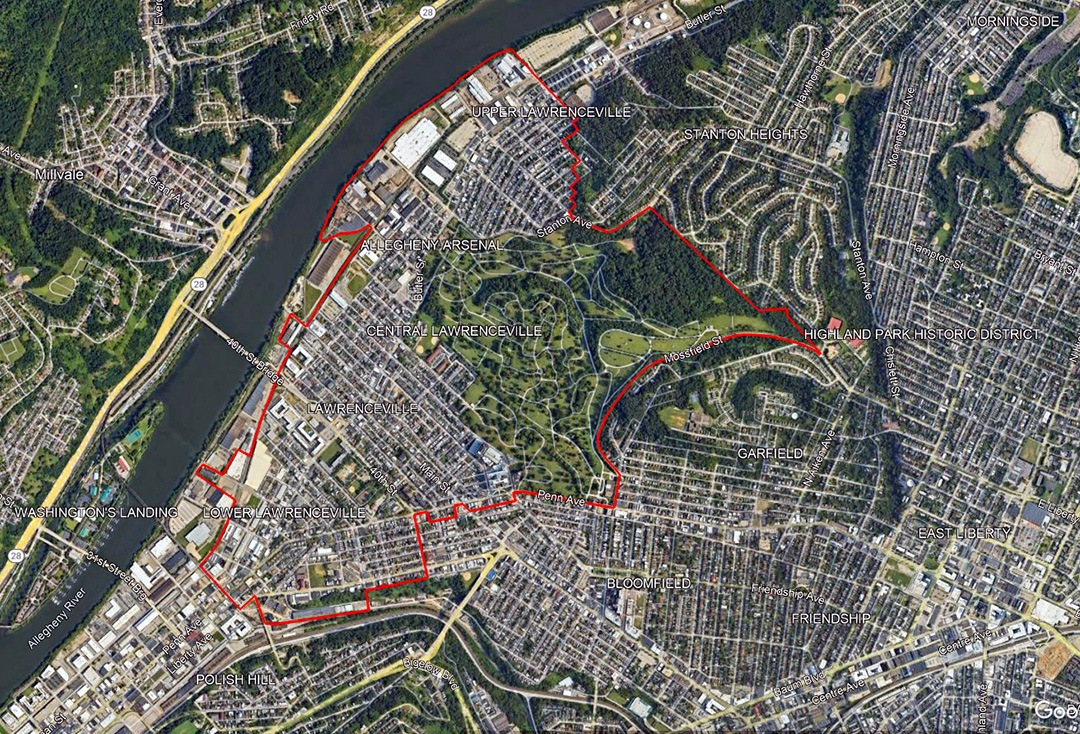
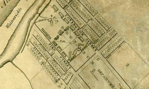
The Allegheny Arsenal is a part of the Lawrenceville Historic District, which is listed on the National Register of Historic Places. The Historic District encompasses 916 acres and includes 5,217 resources, including residential, commercial, industrial, and institutional buildings, like dwellings, churches, banks, clubs, schools, corner stores, cemeteries, and parks. Lawrenceville contains a mix of many architectural styles, including Italianate, Second Empire, Queen Anne, Romanesque, Gothic, and Art Deco. The Allegheny Arsenal and the village of Lawrenceville were established together in 1814. The village originally consisted of the Arsenal surrounded by almost 200 residential lots and a small street grid. Improvements in transportation brought opportunities for industrial and commercial growth, which brought more people to live and work in the area. In 1868, Lawrenceville was annexed to the City of Pittsburgh. Between 1868 and 1890, Lawrenceville reached its peak of industrial and commercial activity. This was followed by the Industrial Revolution when an influx of immigrants, mainly from eastern Europe, came to the neighborhood and established new religious and cultural institutions. It was during this period that the Arsenal, which had been an integral part of the community since its inception, was decommissioned and no longer housed military personnel who had been a distinctive presence along Butler Street for almost 100 years. This historic map from 1835 shows the Arsenal surrounded by almost 200 residential lots that formed the original village of Lawrenceville. This modern aerial shows the boundary of the Lawrenceville Historic District.
Pittsburgh Mining Experiment Station
1908-1917 U.S. Bureau of Mines
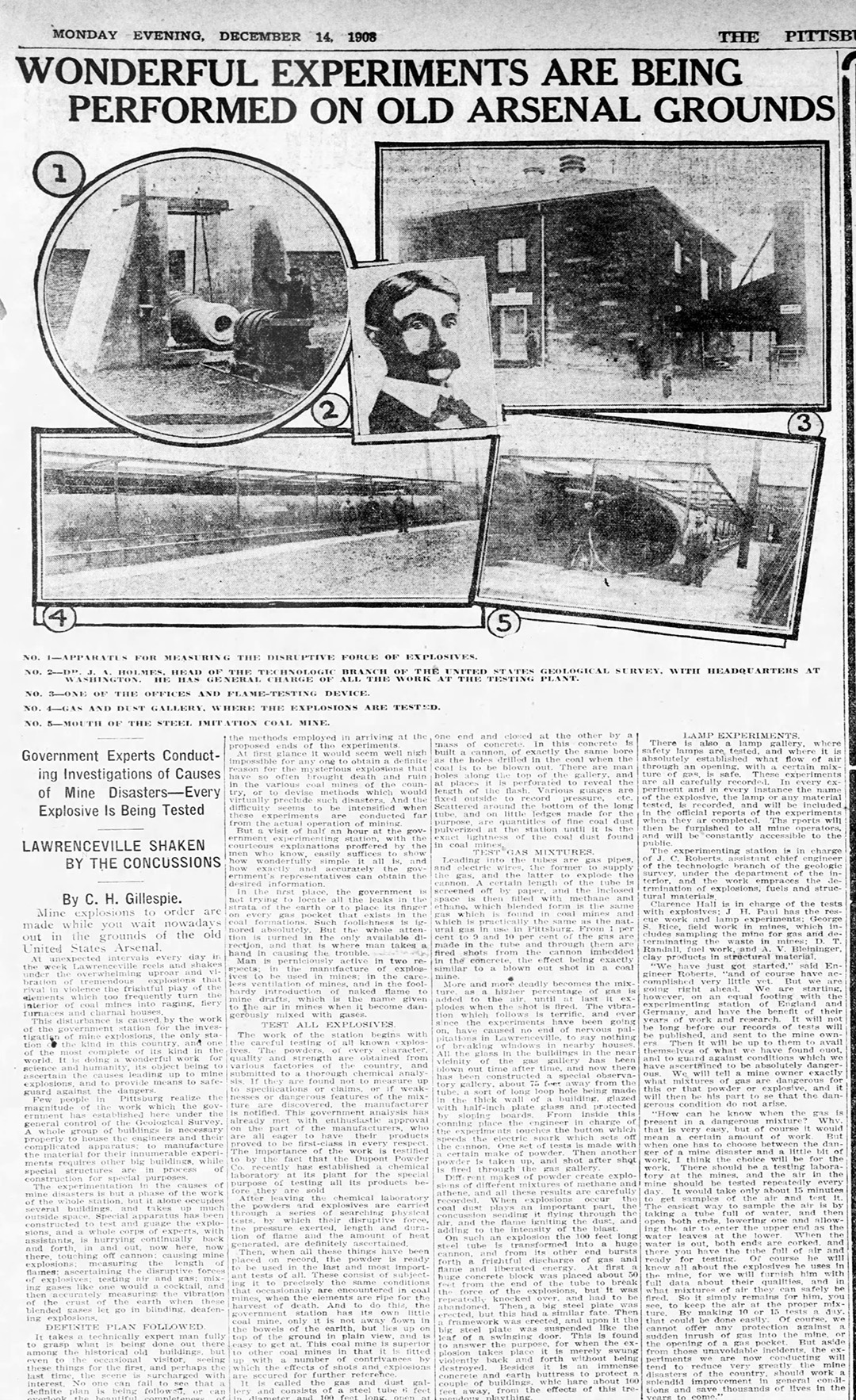
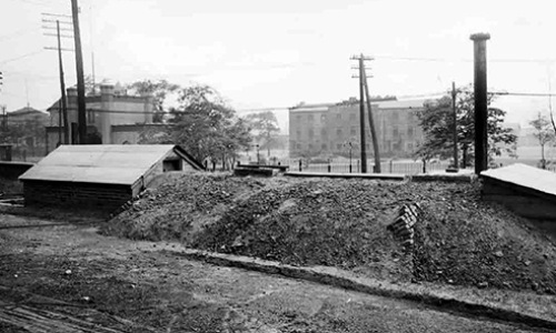
The Allegheny Arsenal was decommissioned in 1906 but the property continued to be owned by the government. Between 1908 and 1917, the Arsenal was given to the U.S. Bureau of Mines to conduct experiments to improve mine safety. Below is a brief history of the Pittsburgh Mining Experiment Station. In June of 1904, the federal government established the Technological Branch of the U.S. Geological Survey for the purpose of improving mine safety. Prior to this time, mine safety had been responsibility of each individual state. By 1907, an average of nine men were dying in mining accidents every day. During the first 20 days of December 1907, 692 miners died in four mining explosions in Pennsylvania, West Virginia, and Alabama, including the worst mining disaster in U. S. history: the explosion of the Monongah Nos. 6 and 8 in Monongah, West Virginia, which alone claimed 362 lives. December 1907 became known as Bloody December. In 1908, in response to Bloody December, Congress designated funds for the U. S. Geological Survey to expand its investigations into the causes of mine explosions. The War Department allotted a portion of the grounds and buildings of the former Allegheny Arsenal to serve as the headquarters and testing grounds for the Pittsburgh Mining Experiment Station (originally the Pittsburgh Explosive Testing Station). A few years later, in 1910, the Bureau of Mines was created to take over the responsibility of improving mine safety by finding safer blasting materials and preventing gas and dust explosions in underground mines. On December 3, 1908, Pittsburgh Mining Experiment Station began operations on the grounds of the former Allegheny Arsenal. Old Arsenal buildings were repurposed for use as administrative offices and laboratories. New outdoor apparatuses were added in order to conduct explosive experiments and imitate mine explosions. The Bureau installed an imitation coal mine, flame testing device, apparatus for measuring the disruptive forces of explosions, and a gas and dust galley to test explosions. Experiments conducted here in 1909 were able to establish the fundamental relationship between explosive charges and coal dust particles, which had been poorly understood until then. The experiment station in Lawrenceville was the only one of its kind in the U. S. and one of the most complete in the world. Testing methods that began here would evolve into a world center of mine safety science. In 1917, Pittsburgh Mining Experiment Station moved to a new location in the City of Pittsburgh. This historic photograph shows the Fire Mine Gallery beside Butler Street in ca. 1910 (the old Arsenal Guard House and Mess Hall are in the background). This historic newspaper article from 1908 is about the experiments being done at the old Arsenal. This historic map from 1914 shows what the northern part of the Arsenal looked like after it was taken over by the Bureau of Mines.

